


Field Collection and Utility Network Implementation
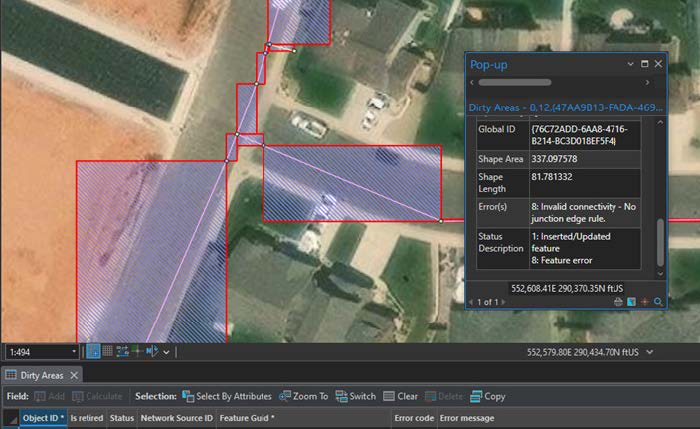
The City of Laramie contracted IMEG to migrate their existing water data into the Utility Network Model. However, there were a number of issues related to the topology and accuracy of the system along with feature alignments. Field crews were sent out over the course of several summers to collect curbstops, meters and other features in the field.
IMEG GIS staff used existing as-builts and field data to correct the overall system insuring the proper connections of assets were in place. Topology rules were used to insure the overall connections in the system were correct. A plan was developed with the City’s staff on the migration process to the Utility Network Model. The data was moved to an asset package to be used in the deployment process. Using the Esri deployment tools, the asset package was moved into the Utility Network Model. Once the Model was in place, the errors which arose were corrected and additional rules were added to correct the errors. Functionality such as isolation traces were tested and insured to work properly.