Fire Recovery Dashboard
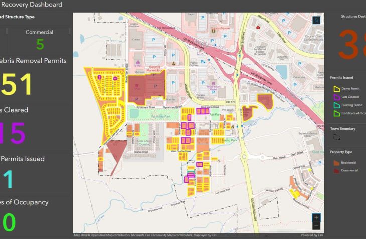
The Town of Superior was decimated by a wildfire at the end of 2021 that swept through residential and commercial areas. In order to aid in the recovery efforts, a dashboard was configured in ArcGIS Online to track the progress. Data associations were configured to link to Boulder County GIS and internally to their permitting and occupancy systems.
The dashboard pulls the data and compiles it to show in real time as the conditions change. This allows users to track the debris and lot clearing both on the local and county efforts. The permitting information shows the active debris, demo, and building permits. As homes are rebuilt it will track the certificates of occupancy and provide the staff and the public an easy-to-use system to see the progress in the recovery of the Town.
