


Tribal Mapping
The project: IMEG is working with five tribes in Montana and Wyoming on the Rocky Mountain Tribal Mapping. The project began in 2009 after receiving direction from “Big” John Smith who stated, “We want our surveyors working on our reservation.”
After reviewing the survey process using GPS units, sending questionnaires to state survey associations, and consulting with the regional National Geodetic Surveyor, the tribes came up with the “Tribal Mapping Project.”
The goal: The Tribal Mapping Project standardizes the land survey process over very large areas through creation and use of low distortion projections.
Benefits: The same projection used in Browning can be used in Heart Butte, East Glacier, Cut Bank, and everywhere in between making it easy to train and coordinate with survey crews to provide extremely accurate information for engineering plans, construction, and GIS. The Handbook and User’s Guide provides step-by-step guidance allowing current and future surveyors to use the system. Continuously Operating Reference Stations
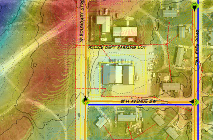
(CORS) and Real Time Networks (RTNs) provide the control to tribal surveyors to more efficiently and accurately conduct surveys. LiDAR and photogrammetry (obtained for the Browning area) then provides survey grade topography for design. Elements of the Tribal Mapping Project are culminated into survey-grade GIS mapping for more effective communication of spatial data.
When the system is used for land survey, it simplifies and streamlines the survey process, saving the tribe money. It will also simplify the coordination between tribal surveyors and IMEG surveyors, saving the tribe more money and keeping more money in the local community. Finally, the data is easily imported into the GIS program ESRI making it simple to communicate project progress with tribal council, tribal programs, and tribal members.
Phasing: Our team is currently in the process of completing phase four and has begun phases five, six, seven, and eight.
- Phase 1 – Low Distortion Projection (LDP) Creation: LDP’s were established on each reservation to minimize map projection errors arising from the use of State Plane Coordinate Systems.
- Phase 3 – Tribal Mapping Handbook Creation: A handbook was written to guide users on tribal coordinate (LDP) use, GPS input, and use in GIS systems.
- Phase 4 – CORS: Tribal team is adding 15 CORS to enhance the existing NGS CORS system.
- Phase 5 – Real Time Network (RTN) Establishment: RTN stations will link to CORS to provide real-time data corrections and allow accurate GPS data to be collected in the field.
- Phase 6 – Survey Grade Data Collection and Compilation: The mapping system will be used to collect highly accurate, survey grade data (Water, Sewer, PLSS, ROWs, Easements), and compile the data in GIS systems for shared use.
- Phase 7 – GIS Platform: Location for data to be stored and easily accessed by tribal officials, programs, and people.
- Phase 8 – LiDAR Mapping: Highly accurate topographic mapping (LQ2 or better) and orthorectified aerial photography (1 foot pixel or better) will be obtained for each reservation for use in planning and design projects.
Influence: The tribal implementation states (Oregon 2010, Iowa 2014, Indiana 2015, Kansas 2017) have recognized the benefits of this work and have done their own mapping projects.
Award: The tribes earned American Council of Engineering Companies (ACEC) Engineering Excellence Honor Awards for the Mapping Technology category in 2013, 2015, and 2017.